The Trestle
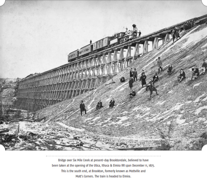
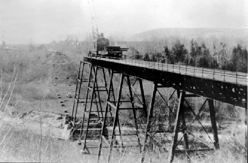
Completed in Dec 1875, a wooden railroad trestle crossed the valley in Mott’s Corners, and at 1600 feet long and 85 feet high and made of foot-square timbers, the massive structure was known outside of Tompkins County. Eventually, the wooden structure became equally infamous for its deteriorating condition, and in 1894, it was replaced by the “Great Iron Bridge at Brookton”, without any interruption in rail traffic. The metal bridge was dismantled in 1935.

Bridge over Six Mile Creek at present-day Brooktondale, believed to have been taken at the opening of the Utica, Ithaca & Elmira RR span December 11, 1875. This is the south end, at Brookton, formerly known as Mottville and Mott’s Corners. The train is headed to Elmira.
— Caroline History Room, Slaterville Springs NY. View largest available size.
The Utica, Ithaca and Elmira Railroad was later known as Elmira, Cortland and Northern Railroad. In 1905 it was absorbed by the Lehigh Valley Railroad. The tracks came out of Ithaca at East Hill up the north side of Six-Mile Creek valley, crossed Brookton on the trestle, crossed the DL&W tracks at Caroline Junction, and continued on to Willseyville.
In 1874 the wooden trestle at Brookton was started, and completed in December 1875. It was made of foot-square timbers cut from area forests and set close together in several tiers 1600 feet long and 85 feet high. It was built for the Utica, Ithaca and Elmira Railroad. “The wooden trestle required a watchman to cross it on foot after each train, just to make sure no fire had started anywhere in its timbers.
“As the old trestle weakened, it seemed so frightening that passenger trains stopped at the approach to either end and let fearful passengers walk across if they chose.
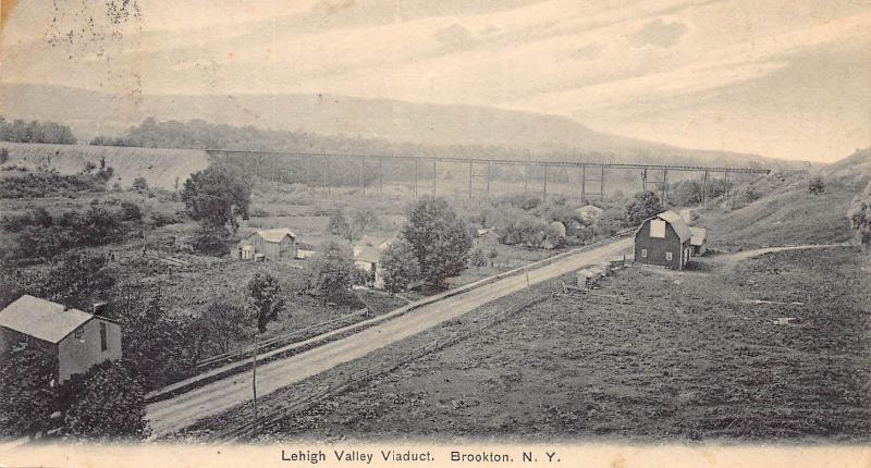
“In 1894 the wooden structure was replaced by one of steel. The work was done by Moses Hurlbut and his crew was quite remarkable, too, in that traffic was never completely stopped for the replacement. The metal bridge was placed without fully tearing down the old wooden one beforehand.
“The crew worked through the week preparing sections of the old trestle for removal and then, on Sunday, when no trains ran, a single span would be cut out and replaced. During the entire rebuilding program, not one train missed its schedule because of the trestle-builders’ activities."(Ithaca Journal–Glance Backward by Barbara Bell)
The steel trestle was about 800 feet long and 85 feet high at its highest point over the valley. It was called “the new bridge” and Lyman Gallagher of Slaterville said that “old valley residents who had lived 50 years in the protection of that gigantic wooden windbreak, practically were blown out of their homesteads when the new steel bridge failed to stop the force of the winds up the valley.”
Lehigh Valley Railroad service was discontinued on 1 July 1935 on the old branch line over the stretch from Van Etten to East Ithaca. The “last” passenger train out of Ithaca to Owego over the 110 year old Cayuga-Susquehanna & Western branch of the Delaware, Lackawanna & Western Railroad, was on Palm Sunday and in short order, the trestle was taken down by a small crew of Bethlehem Steel company workmen.
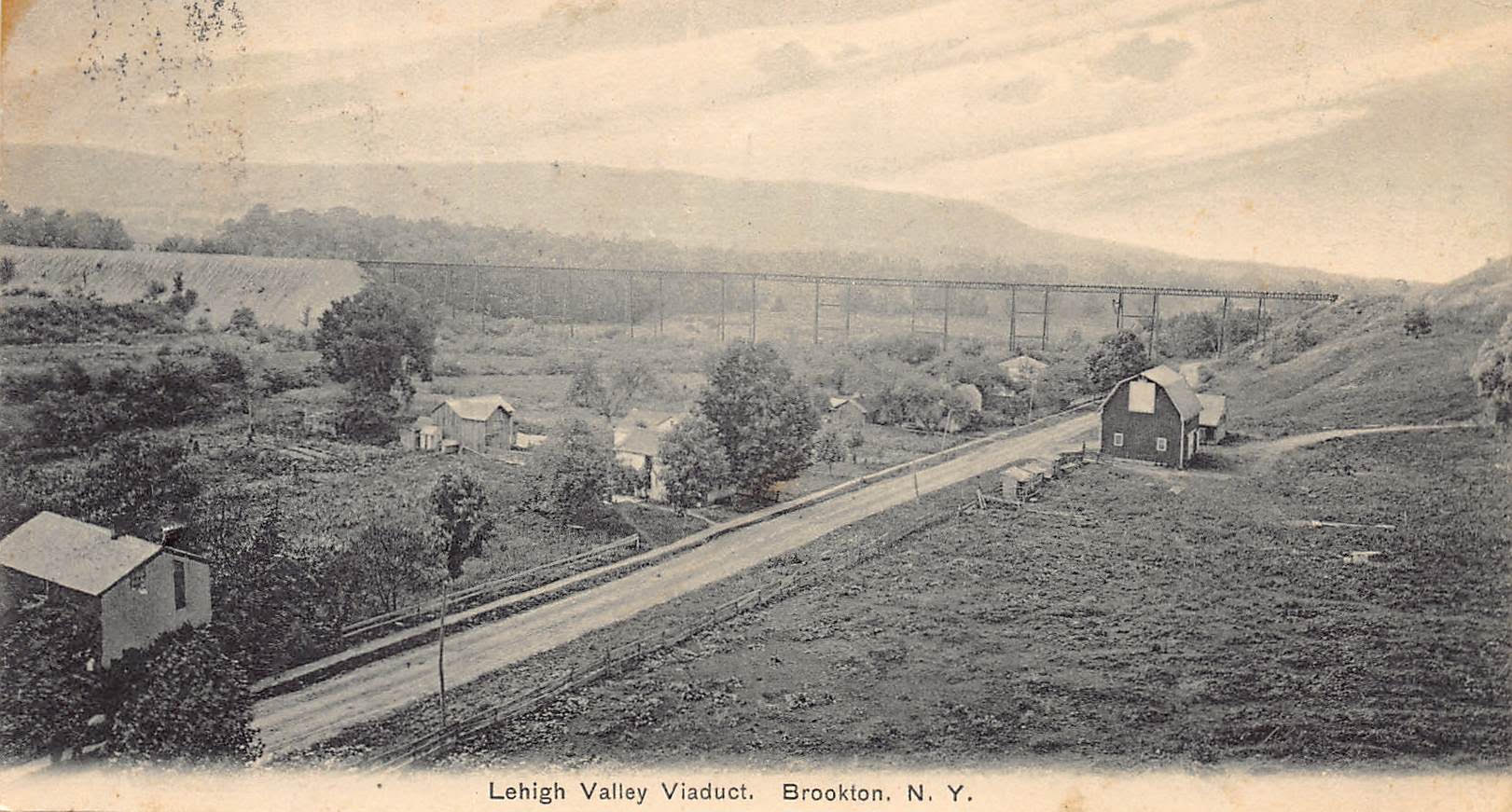
The “Great Iron Bridge at Brookton” in the photograph below replaced the original wooden trestle. A version of this postcard can be found on page 57 in The Towns of Tompkins County: From Podunk to the Magnetic Springs edited by Jane Marsh Dieckmann, which states it was taken in 1907, when Edward Mills was still alive.
Note that the photographer is standing on or very near the “brow of the hill” that forms the western boundary of the Mills’ Home parcel. I have tried to recreate this photograph to get a more exact idea of where the photographer was standing, but the view is now obscured by trees, making it difficult. However, I think that the photographer was in the general area of the concrete marker on the hill brow as it descends back toward Brooktondale Road, above where the concrete retaining wall is presently. That concrete marker is represented on the survey maps of 475 Brooktondale Road.
The wooden trestle had been in place for four years when the Mills family arrived in Mott’s Corners in Mar 1879, and the iron trestle was dismantled in the final years of Emily’s life. The trestle was easily visible from both Mills’ store–particularly from Lounsbery Hall, and Mills’ Home.

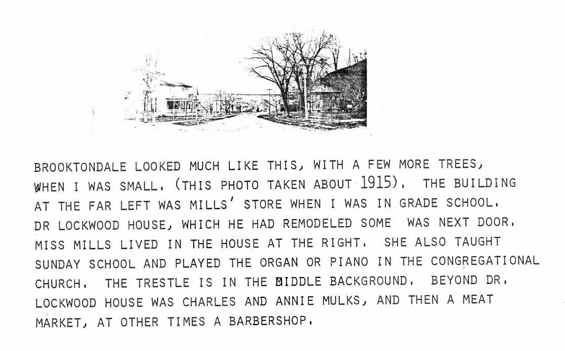
Brooktondale looked much like this, with a few more trees, when I was small. (This photo was taken about 1915). The building at the far left was Mills’ store when I was in grade school. Dr. Lockwood house, which he had remodeled some was next door. Miss Mills lived in the house at the right. She also taught Sunday School and played the organ or piano in the Congregational Church. The trestle is in the middle background. Beyond Dr. Lockwood house was Charles and Annie Mulks, and then a meat market, at other times a barbershop.
— Gertrude Conant. Used with permission. View largest available size.
As automobile and truck traffic increased, train traffic decreased. When the Brooktondale trestle was damaged in the 1935 flood, it was abandoned by the Lehigh Valley Railroad and demolished for scrap. The Brooktondale and Besemer stations closed.
— Molly Adams, “Town of Caroline” in The Towns of Tompkins County: From Podunk to the Magnetic Springs edited by Jane Marsh Dieckmann, p64.
— Caroline History Room, Slaterville Springs NY. View largest available size.
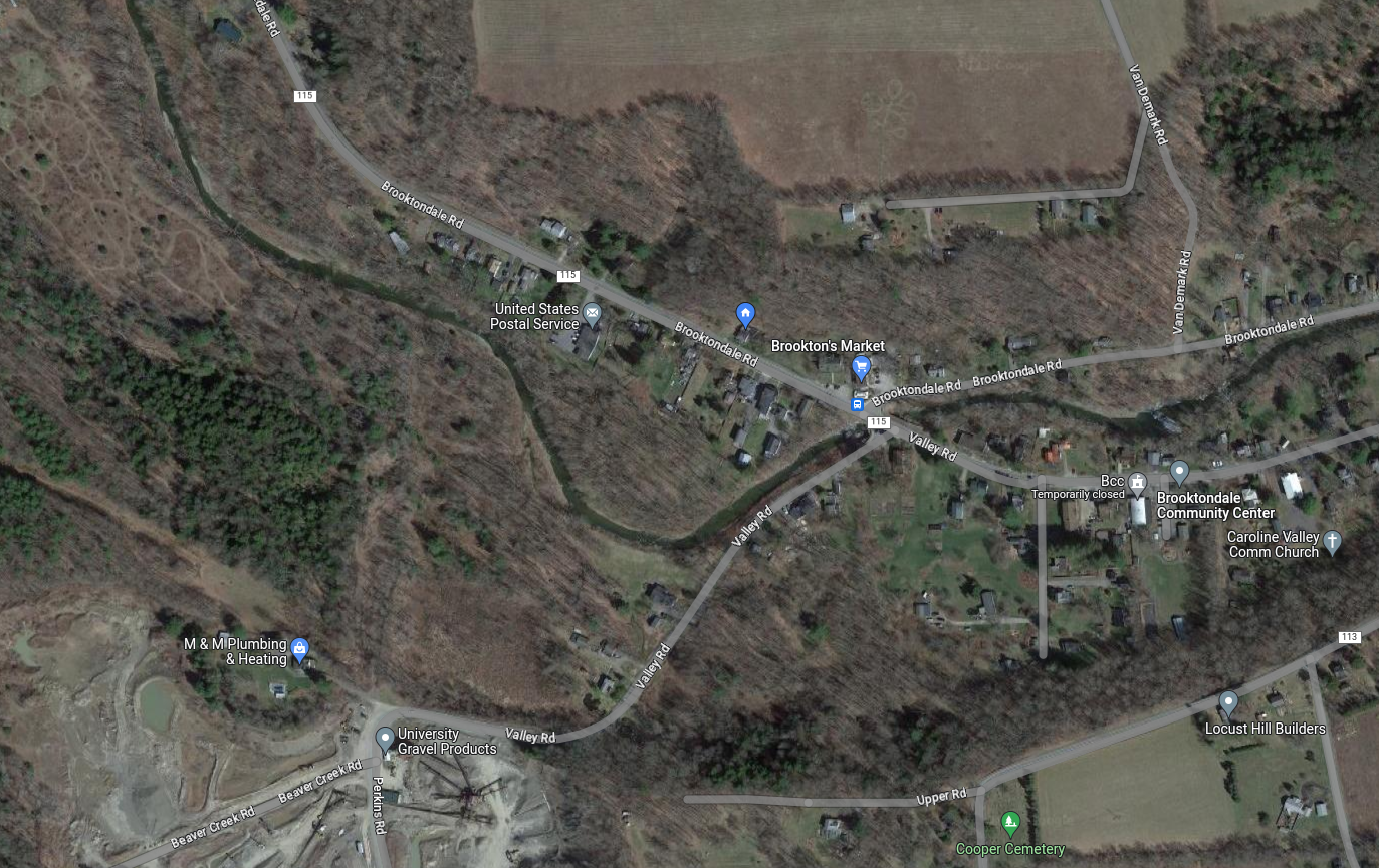
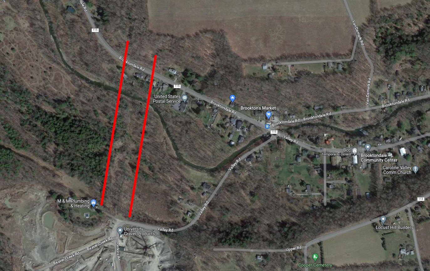
Satellite images from Google Maps still show evidence of the trestle’s path in the landscape, in the area between the red lines in the second image:
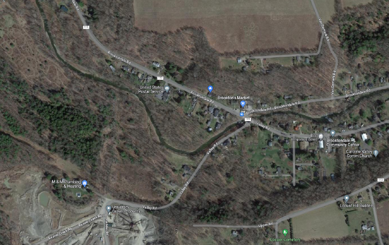
— Google Maps. View largest available size.

— Google Maps. View largest available size.
As I write this, the entire railbed path from where the trestle ended on the northern side of Brooktondale Road to the former site of Besemer Station near present-day Route 79/Slaterville Road, is still quite clearly distinct in the landscape and is a pleasant walkway for the curious. There are a few streams that no longer have bridges crossing them, although evidence of the bridge abutments is still visible in the landscape. Otherwise, the path is still quite clear for long stretches.
The most specific representations of the trestle I have seen can be found in the 1912 highway surveys.
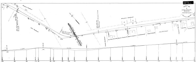
— 26 Feb 1912, Plans for Improving the Cooks Corners-Brookton: Slaterville Springs-Caroline County Highway, Instrument number BF033282-001, Sheet 5, Tompkins County Clerk, Ithaca NY. Cropped. View largest available size.
In the map above, the Mills’ family barn is represented, as well as a portion of the grist mill tailrace south of Creek Road. The map below shows the iron trestle, Mills’ Home, and the raceway.
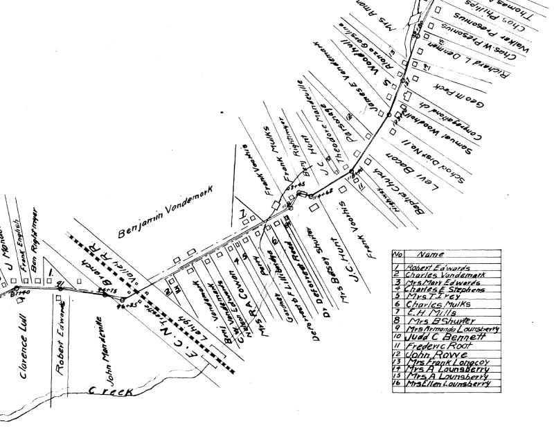
— 26 Feb 1912, Plans for Improving the Cooks Corners-Brookton: Slaterville Springs-Caroline County Highway, Instrument number BF033282-001, Sheet 1, Tompkins County Clerk, Ithaca NY. Cropped. View largest available size.
These maps are explored further in the The Mill Race Bridge and The Barn section.